
land surveying
How a Topographic Survey Reveals Hidden Land Risks
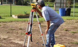
Construction projects often start with excitement. A homeowner plans a new house. A developer prepares a new building site. However, the land itself can hold
Construction projects often start with excitement. A homeowner plans a new house. A developer prepares a new building site. However, the land itself can hold
Many homeowners believe their property line sits exactly where the fence stands. It feels logical. After all, fences usually mark the edge of a yard.

If you have called around for a survey lately, you have probably asked the same question many homeowners ask: Why is the property survey cost