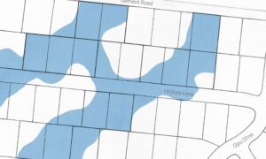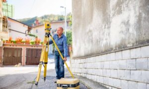
As Huntsville continues to grow, zoning compliance is more important than ever for builders and developers planning mixed-use or sloped sites. LiDAR mapping helps builders, engineers, and planners make sure every project fits within the city’s zoning laws. With fast, accurate 3D data, LiDAR mapping shows exact land shapes, boundaries, and building heights—making it easier to avoid costly mistakes or permit delays.
The Challenge of Zoning in Mixed-Use Growth Areas
Huntsville’s development boom has led to mixed-use zones where homes, shops, and offices are all close together. This is great for smart growth, but it also creates zoning challenges. A small error in a setback, lot line, or building height can lead to zoning violations.
In fast-changing areas like MidCity and near Research Park, zoning maps are updated often. Builders must follow local rules for spacing between buildings, sidewalks, parking lots, and public access. Without clear elevation and boundary data, projects can easily fall out of compliance.
How LiDAR Mapping Supports Zoning Accuracy
LiDAR mapping provides a detailed 3D view of the land. It shows not just the shape of the ground, but also nearby buildings, vegetation, and elevation changes. This data helps teams:
- Verify property lines and lot dimensions
- Measure building heights and roof slopes
- Confirm setbacks, easements, and utility paths
- Check slopes and drainage areas that affect zoning
- Avoid protected areas like flood zones or school buffers
Because the data is highly accurate, it can be used during design, permitting, or zoning appeals.
Real Examples in Huntsville Projects
Many builders now rely on LiDAR mapping for development projects in Huntsville to stay compliant with zoning laws and avoid design errors. For example:
- A new mixed-use site on University Drive used LiDAR to map rooflines and lot edges to meet height limits.
- In North Huntsville, a redevelopment team used LiDAR to adjust parking layouts and avoid building too close to residential lots.
- Downtown developers have used it to measure building heights and align new structures with sidewalk zones and pedestrian paths.
Better Coordination with LiDAR Data
Zoning compliance often involves several teams: engineers, surveyors, architects, and city officials. LiDAR mapping gives everyone access to the same accurate data, which helps with:
- Faster design approvals
- Fewer site visits or manual checks
- Improved communication with city zoning departments
- Easier plan changes when needed
This kind of coordination helps reduce errors and keep projects moving forward.
Long-Term Benefits for Risk and Compliance
Using LiDAR early in a project reduces the chance of zoning mistakes. It can help avoid delays, fines, or forced redesigns. LiDAR also supports long-term planning, especially for large projects with multiple phases or different zoning needs.
Builders who use LiDAR data can also show proof of compliance if a question comes up during inspection or resale. Having clear digital records helps protect against future zoning disputes.
FAQs
1. How does LiDAR mapping help meet Huntsville zoning code?
It provides accurate 3D data that shows property lines, building heights, and distances—key parts of zoning rules.
2. Is LiDAR accurate enough for permit submission?
Yes, LiDAR data can be used alongside traditional surveys to support permit applications and zoning documents.
3. Can LiDAR help during rezoning or zoning appeals?
Absolutely. It helps prove how land is shaped or used, which can support requests for rezoning or variances.
4. How is it different from a standard boundary survey?
A boundary survey shows property lines. LiDAR adds elevation, slope, and building details to create a 3D view of the whole site.
5. Do planners in Huntsville accept LiDAR-based reports?
Yes, especially when combined with licensed surveyor input. It’s becoming more common in complex or multi-use projects.

