Decatur is no stranger to water. With the Tennessee River and Wheeler Lake shaping the city’s edges, flood risk is always part of the conversation when it comes to land and property. Before you order a property survey for a new build, a home purchase, or an insurance requirement, it helps to take a quick look at whether your land sits in or near a flood zone. The good news? You can do a simple pre-check yourself in just a few minutes using free online tools.
This quick step doesn’t replace a professional survey, but it can save time, money, and headaches down the road. It gives you a snapshot of your risk so you know what questions to ask and what documents you may need.
Why a Flood Risk Pre-Check Matters
Living near water has its perks, but it also brings uncertainty. Flood zones affect more than insurance; they can impact building permits, resale value, and even mortgage approvals. If you skip the research, you may be caught off guard when a lender requests an Elevation Certificate at the last minute or when a city permit is delayed.
By taking a few minutes to look at public maps, you’ll know if your land might be affected. You’ll also be better prepared to explain your situation when you call a surveyor. That makes the process smoother and often faster.
Step One: Download a FEMA Flood Map (FIRMette)
The Federal Emergency Management Agency (FEMA) provides free digital maps that outline flood zones across the country. These maps are called FIRMettes.
Here’s how to use them:
- Go to FEMA’s Map Service Center website.
- Enter your property address in the search bar.
- Select “Make a FIRMette” to create a custom PDF map of your lot.
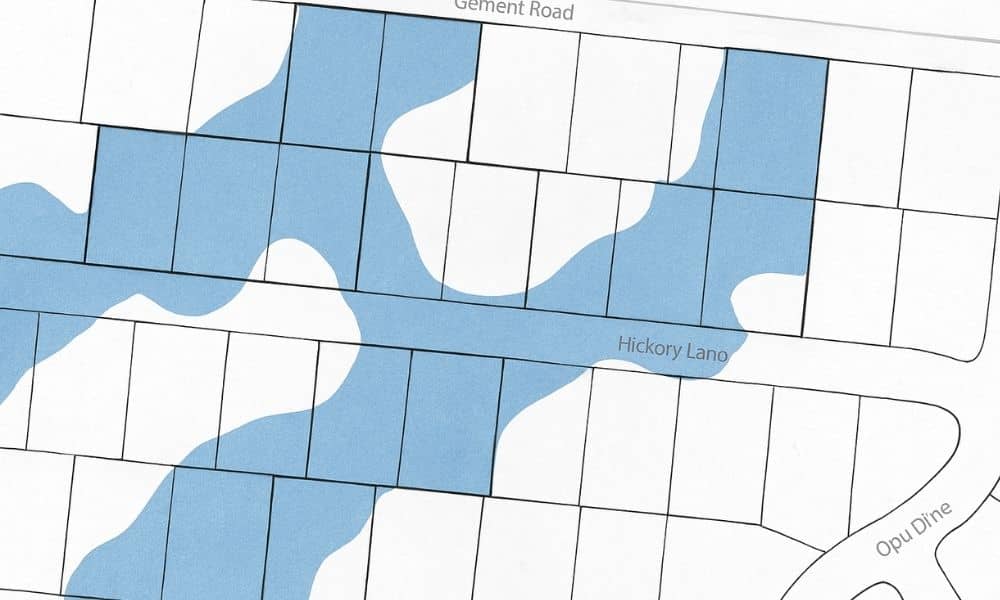
On this map, pay attention to the colors and labels. Zone X usually means minimal risk, while Zone AE means higher flood risk and stricter insurance rules. If your parcel touches a shaded zone, you’ll want to keep digging.
This map is your first look at where the government considers flood zones to be. Think of it as the baseline, but not the full picture.
Step Two: Check Morgan County’s Parcel Viewer
Next, visit the Morgan County Parcel Viewer online. This tool lets you pull up property lines, easements, and parcel IDs. It’s easy to use:
- Enter your property address or parcel number.
- Turn on the parcel boundary layer to see the exact outline of your lot.
- Print or save a screenshot of your map.
Now you have a detailed image of your specific property. While FEMA shows the broader flood zones, the parcel viewer shows your exact lot lines. Laying these maps side by side is where things get interesting.
Step Three: Compare the Maps
This is where you’ll spot potential trouble. Overlay the FEMA flood zone map with the parcel map. Even without special software, you can compare the two side by side on your screen or with printed copies.
Ask yourself:
- Does my property overlap a shaded flood zone?
- Is it close to a floodway or labeled Base Flood Elevation (BFE) line?
- Do any easements or drainage areas run across my lot?
If the answer to any of these is yes, you’re in an area where flood risk is more than theoretical. It doesn’t mean you can’t build or buy, but it does mean a professional surveyor will be needed to confirm elevations.
Step Four: Know When a Property Survey Is Essential
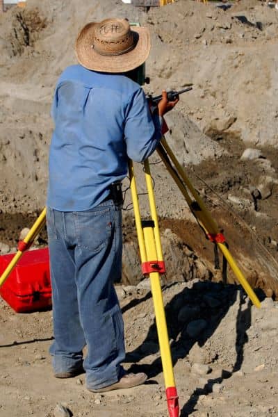
If your property is even close to a flood zone, stop guessing and call a licensed surveyor. A property survey goes beyond the maps and provides precise measurements on the ground. In these cases, the surveyor often prepares an Elevation Certificate, which shows key data such as:
- Finished floor elevation (FF)
- Lowest adjacent grade (LAG)
- Highest adjacent grade (HAG)
This information is what lenders and insurance companies use to set requirements and rates. Without it, you may not be able to close on a loan or get affordable flood insurance.
In short: public maps are the preview, but property surveys provide the proof.
Bonus: Track Daily Water Levels
Flood risk isn’t only about maps. It’s also about the Tennessee River’s day-to-day behavior. Fortunately, both TVA (Tennessee Valley Authority) and NOAA post water level updates online. You can check Wheeler Lake levels or the river gauge to see real-time conditions.
Why does this matter? Even if your property isn’t in a mapped flood zone, high river stages can affect drainage, soil saturation, and long-term site planning. Builders, buyers, and homeowners benefit from paying attention to these numbers. It’s a small habit that can prevent big surprises.
Final Thoughts:
A flood risk pre-check is like a warm-up before the real workout. It doesn’t replace hiring a surveyor, but it helps you step into that conversation informed and confident. You’ll know whether to ask about Elevation Certificates, whether to budget for flood insurance, and how soon you need the survey completed.
In Decatur, where water is part of the landscape, this quick research can save you from delays or costly missteps. And when you’re ready for the full picture, a licensed surveyor is the one who can provide it.
