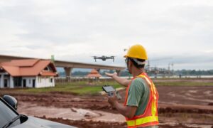
If you’ve worked on a job site, you already know how unpredictable the field can be—especially for construction surveyors working under tree cover or in remote areas. One minute your RTK system is locked in; the next, your signal drops out and your GPS rover can’t hold a fix. When that happens, panic can spread fast. Crews stall. Layout schedules slip. Clients get frustrated. But it doesn’t have to be that way. With the right plan, you can turn a signal loss into just a 30-minute pause—then keep your project on track without sacrificing accuracy. This is the rescue protocol every construction surveyor should master.
Why RTK Fails (and Why It’s Not Your Fault)
Let’s start with the basics. RTK, or Real-Time Kinematic positioning, relies on constant communication between your rover and a base station—or a network of reference points—to get centimeter-level accuracy.
The problem is, Alabama isn’t exactly a signal-friendly environment. Around Maxwell and Montgomery, tall pines, thick humidity, and clay-heavy soils cause multipath errors—where GPS signals bounce off surfaces before hitting your receiver. Add in a weak cell connection or a solar storm, and your corrections vanish.
Even the best equipment can’t fight physics. But what separates average surveyors from dependable professionals is how fast they recover.
Step 1: Secure Two Reliable Control Points
When RTK fails, your first goal isn’t to fix the signal—it’s to protect your accuracy.
Set two temporary control hubs on opposite ends of your site. If you’re lucky enough to have an open area, occupy one hub there first. Let the rover sit for about three minutes in the open sky to stabilize coordinates. Then move to your second point under partial canopy and record a longer, five-minute observation.
Why the extra time? Because the more satellite data you collect, the better your post-processing later. This gives you a safety net if your live RTK can’t recover right away.
Once both hubs are logged, double-check by looping back to your first point. If your readings are consistent, you’ve already built a strong control backbone to finish the job.
Step 2: Keep Work Moving with Total Station
Here’s the part that saves your schedule. Don’t stop the crew.
Switch to your total station for critical layout tasks—curb lines, corners, benchmarks, and utility stakes. The total station gives you precise angles and distances even when satellites are blocked. Meanwhile, your rover data continues collecting quietly in the background.
This is where experience pays off. While some surveyors pack up and wait for clear skies, smart crews use this downtime to handle everything that doesn’t depend on GPS.
Clients love this approach because it shows professionalism: you’re not wasting time; you’re adapting.
Step 3: Run a Quick OPUS Fast-Static
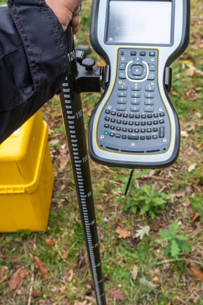
While your team keeps shooting with the total station, take one of your control points—preferably the one with the best sky view—and record a 5–15-minute static session.
Later, you’ll upload this data to OPUS (Online Positioning User Service) for post-processing. OPUS uses national reference stations to calculate an accurate position, often within a few centimeters.
Once you get that processed coordinate back, plug it into your rover and re-initialize your local site calibration. You can then tie your total station work to the corrected control points and resume normal RTK operations.
From start to finish, this rescue protocol takes roughly 30 minutes. That’s a short break compared to the hours you’d lose waiting for the weather—or the signal—to cooperate.
Step 4: Double-Check Your Quality
Before calling it a day, review your collected data. Look for GNSS points that show PDOP (Position Dilution of Precision) higher than 3 or RMS errors over 0.03. These are your outliers—mark them, verify them, or replace them with total station shots if needed.
Add a short note in your survey report about the canopy or storm conditions that caused the outage. This not only keeps your documentation transparent but also reassures clients that you took every step to protect accuracy.
That small bit of communication can prevent future disputes and strengthen your reputation for diligence.
Why It Works So Well for Alabama Projects
This 30-minute protocol is built for real-world conditions in places like Montgomery, Pike Road, and Prattville—where construction surveyors deal with canopy cover, clay-rich soils, and sudden weather swings.
It’s not a complicated or tech-heavy fix. It’s a workflow—a mix of quick thinking, basic control, and smart sequencing.
Instead of hoping your RTK holds steady, you plan for the moment it doesn’t. You stay productive, protect your control, and deliver the data your engineers and contractors rely on.
That’s how trusted surveyors earn repeat clients—by staying dependable no matter what the sky does.
The Bigger Picture: Turning Setbacks into Strengths
The truth is, field conditions will never be perfect. GPS dropouts, firmware glitches, or even solar interference can strike anytime. But if you’re prepared, these aren’t setbacks—they’re opportunities to show your professionalism.
Every client wants a construction surveyor who can adapt under pressure. When they see your crew calmly transition from RTK to total station, then back again with zero loss of precision, it builds confidence.
And confidence is what keeps your phone ringing with referrals.
Final Thoughts
Surveying isn’t just about collecting points—it’s about managing reality. Trees, storms, or signal loss won’t stop a well-prepared construction surveyor from delivering results on time.
The next time your RTK drops under the canopy, don’t panic. Follow the 30-minute rescue plan:
- Secure your two control points.
- Keep the crew productive with total station work.
- Run a short OPUS fast-static for correction.
- Verify your data and document conditions.
By the time another crew is still refreshing their GPS connection, yours will already be back on track—accurate, efficient, and professional.
Every field crew faces tough conditions at some point. What matters is how construction surveyors respond when technology stumbles — that’s where skill truly shows.
