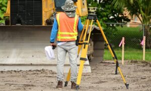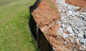
When the City of Huntsville approved a new $240 million retail center in North Huntsville, it marked another big step in the city’s growth story. New stores, restaurants, and office spaces are on the way, and construction teams are already lining up their next moves. But behind every successful project like this, there’s something most people don’t see — the early groundwork that keeps everything running smoothly. That’s where the ALTA Land Title Survey comes in.
Long before concrete is poured or blueprints are finalized, this detailed survey helps developers, lenders, and title companies confirm exactly what’s on the land and where it sits. And in a fast-moving market like Huntsville, ordering it early can make all the difference between hitting your deadlines and watching them slip away.
Why Survey Timing Can Make or Break a Project
When big projects get the green light, there’s a rush behind the scenes. Developers want to move fast. Lenders want closing documents ready. Engineers and architects want data they can trust. The problem? Everyone needs the survey first.
In North Huntsville, construction activity is booming. Surveyors are busier than ever, and scheduling one at the last minute can delay everything — from loan approvals to site grading. That’s why smart developers start early. They don’t wait until the lender requests an ALTA survey; they book it the moment the deal is under contract.
An ALTA Land Title Survey isn’t just another box to check. It connects what’s recorded in the title with what exists on the ground — boundaries, easements, improvements, and any potential conflicts. When you have that data early, your entire project team can plan with confidence.
From Paper to Dirt: What Happens After Approval
The city’s $240M retail hub will require multiple steps before the first shovel hits the ground — zoning confirmations, plat recording, stormwater planning, and lender sign-offs. Each of those depends on having accurate land information from the start.
Think of the survey as the base map for everything else. The engineers use it to design drainage and grading. The lenders use it to approve financing. The title company relies on it to confirm boundaries and easements. When one part of that chain slows down, the whole timeline gets pushed back.
Ordering your ALTA Land Title Survey early prevents those bottlenecks. It gives surveyors enough time to research property records, locate monuments, and prepare maps that meet both ALTA and NSPS standards. It also allows time to fix small issues — like missing legal descriptions or unclear easement lines — before they grow into big delays.
Why Huntsville’s Boom Makes Early Surveys Essential
North Huntsville is changing fast. Empty parcels are turning into commercial hubs, and previously quiet zones are now surrounded by new traffic and utilities. With that growth comes a higher risk of overlapping easements, shared access points, and conflicting records.
Surveyors in the area often have to piece together old plats, past subdivisions, and new utility maps. If your project sits near a new road or a shared parking lot, there’s a good chance more than one party has rights to use parts of the land. Only a full ALTA survey can verify those details clearly.
And timing matters even more here. As more developments break ground, surveyor availability becomes limited. Waiting until your closing date to start the process could push you back weeks — and in commercial real estate, time really is money.
Floodplain Surprises Developers Can Avoid

Another reason to plan early? Huntsville’s terrain looks simple, but it hides a few surprises. Northern sections of the city slope toward flood-prone areas that can affect site design and permitting.
A complete ALTA Land Title Survey often includes flood data from FEMA maps, helping developers understand if part of their property falls within a flood zone. If it does, engineers may need to adjust grading plans or apply for a Letter of Map Amendment. Handling this upfront keeps your project moving instead of waiting on paperwork later.
Even better, by reviewing flood zones early, you can budget for drainage infrastructure before construction bids start coming in. That’s a huge advantage when managing costs on large projects like the new retail center.
Turning Survey Data into Real Progress
Once the ALTA survey is complete, it becomes the backbone of the project. The data feeds into everything — from engineering drawings to construction staking. Crews depend on that accuracy to set building corners, plan utilities, and align parking lots.
If that survey arrives late or needs corrections, every other department stalls. Civil engineers can’t finalize grading. Contractors can’t order materials. The lender won’t close. That’s why early coordination is key. When developers submit survey requests early, they give everyone on the project more room to work efficiently.
Modern tools make this process even faster. Many local surveyors now integrate CAD and GIS data directly into design files, reducing turnaround time and errors. The result? Projects move from survey to site work in days instead of weeks.
Lessons Developers Can Learn from Huntsville’s Growth
The $240M North Huntsville project isn’t just a local milestone — it’s a clear reminder of how fast the region is developing. City planners are approving record numbers of permits, and infrastructure upgrades are already stretching northward toward Meridianville and Hazel Green.
For developers watching this growth, there’s a lesson here: whoever controls the survey schedule controls the project timeline.
By the time permits are filed, the most sought-after surveyors may already be booked. Starting early ensures your project stays at the front of the line. It also gives lenders, engineers, and title officers time to review and resolve issues long before closing.
The Smart Move for North Alabama Projects
Whether you’re planning a retail build, office park, or mixed-use development, one rule applies — don’t wait for the lender to ask. Get your ALTA Land Title Survey started as soon as you’re serious about the property.
It’s not just a document; it’s your foundation for everything that follows. It proves ownership boundaries, uncovers restrictions, and keeps your financing and design on schedule.
Huntsville’s north side is gearing up for big things, and opportunities move quickly. Developers who act early stay ahead of the curve — while those who wait risk being stuck in the backlog.
If you’re preparing for your next project, take the proactive route. Order your ALTA Land Title Survey early, review the results with your engineer, and move toward construction with confidence.
Because in a city that’s growing this fast, the smartest developers don’t just build — they prepare.


