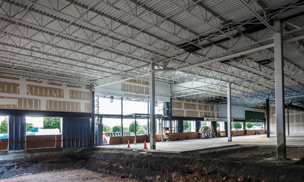
A FEMA Elevation Certificate is a critical document for any retail construction project in a flood-prone area. In Auburn, AL, where commercial development often borders drainage routes and low-lying roads, this certificate helps prove that your building meets floodplain management requirements. It’s not just a formality—it influences permitting, insurance rates, and long-term property safety. In this article, we’ll explore elevation-based construction strategies and how we help developers and engineers stay compliant from planning to completion.
Floodplain Exposure in Auburn’s Commercial Corridors
Some of the most desirable land for retail growth in Auburn sits close to drainage features or highways with slope runoff. These areas are often mapped in FEMA flood zones.
Developers must pay attention to:
- Base flood elevation (BFE) values from local maps
- Site-specific risks based on nearby drainage channels or low spots
- City expectations for finished floor height and stormwater controls
Choosing land without reviewing these details can result in major cost increases later.
Site Feasibility Assessment Before Retail Pad Investment
Before investing in a site, elevation research is critical. Start with a review of FEMA Flood Insurance Rate Maps (FIRMs) and local ordinances.
Steps include:
- Verifying whether the property sits in a Special Flood Hazard Area (SFHA)
- Checking base elevation benchmarks across the parcel
- Considering how nearby infrastructure may help or complicate drainage
An early elevation survey for floodplain development helps determine if a retail pad sits below base flood elevation and whether adjustments are needed before construction begins.
Elevation-Driven Pad Construction Options for Flood Risk Areas
In flood-prone zones, base elevation affects everything—from structure type to long-term durability.
Options include:
- Raised fill pads to lift the foundation above base flood elevation
- Structural slab systems elevated with reinforced forms
- Pier-and-beam setups to minimize contact with the ground in shallow flood zones
Each method must match FEMA guidelines and local code requirements.
Drainage Management and Perimeter Grading in Low-Lying Lots
Good drainage can protect a structure from damage, even during small storm events. Site grading and runoff planning are critical.
Helpful strategies:
- Sloping the ground away from walls and entrances
- Adding swales, inlets, or detention areas to collect runoff
- Keeping ramps, loading docks, and drive lanes clear of standing water
Without these steps, water can back up around the structure—especially if elevation is close to BFE.
Coordination Between Surveyors, Engineers, and Builders
Team communication ensures elevation data is used correctly throughout the build.
How we support this process:
- Delivering certified elevation data for pre-slab inspections
- Aligning survey benchmarks with grading and drainage plans
- Verifying pad elevation before foundation work begins
Accurate surveying for FEMA compliance helps reduce delays and supports smoother approvals for permits, insurance coverage, and occupancy clearance.
Documentation Supporting Long-Term Site and Insurance Viability

Once construction is complete, maintaining accurate elevation data protects the property over time.
- FEMA-compliant elevation certificates help with insurance quotes
- Lenders and inspectors use these documents for occupancy clearance
- If maps change or the site is sold, records help with future permits or claims
Proper documentation ensures that flood-related risks are tracked and managed well beyond the construction phase.
❓FAQs
1. Why is a FEMA Elevation Certificate needed for commercial pads in Auburn?
A FEMA Elevation Certificate verifies that a structure is built above the base flood elevation (BFE). It is commonly required for flood zone permitting, insurance qualification, and code compliance.
2. Can a retail pad be developed in a flood zone?
Yes, but it requires detailed planning. Site elevation, flood-resistant construction methods, and local drainage requirements must all be carefully considered to meet safety and compliance standards.
3. When should a surveyor be involved in site planning?
Ideally, surveying should occur before grading or design begins. Early elevation data helps align construction with FEMA, insurance, and municipal regulations, reducing the risk of costly revisions.
4. What happens if the elevation is too low after construction?
Buildings constructed below the base flood elevation may face permitting delays, higher insurance premiums, or occupancy challenges. It may also trigger corrective actions before clearance.
5. What documents are typically used for FEMA compliance?
Commonly referenced documents include certified elevation data, FEMA-compliant elevation certificates, grading plans, and as-built surveys. These are used by engineers, city officials, and insurance providers during review.


