Buying or developing land is exciting, but it also comes with risks. If you don’t know exactly where your property lines are, you could face legal issues, construction delays, or costly mistakes. That’s where land surveying comes in. A professional land surveyor ensures that you understand your land’s boundaries, topography, and legal requirements before making any major decisions.
Whether you’re purchasing land for a home, business, or development project, hiring a professional land surveyor in Daphne, AL, or Mobile, AL, can help you avoid costly mistakes. Let’s break down why it matters, when you need one, and how to choose the right surveyor for your needs.
What Is Land Surveying & Why Does It Matter?
A land survey is a detailed map of your property. It shows boundaries, improvements, and features that affect land use. Land surveyors use high-tech equipment and legal documents to determine property lines with accuracy.
Why Land Surveying Is Important:
✔️ Avoid Boundary Disputes – A survey helps prevent conflicts with neighbors over property lines.
✔️ Ensure Legal Compliance – Building on the wrong spot could lead to fines or forced removal.
✔️ Protect Your Investment – Know exactly what you’re buying before signing any contracts.
✔️ Plan for Development – Helps architects, engineers, and builders work with confidence.
Types of Land Surveys
Different projects require different types of land surveys. Here are the most common ones:
1. Boundary Survey
📍 Determines property lines and corners. Used before buying or selling land.
2. Topographic Survey
📍 Maps out land features like elevation, slopes, trees, and water bodies. Helpful for construction planning.
3. ALTA/NSPS Land Title Survey
📍 Required by lenders and title companies to confirm land ownership and legal use.
4. Construction Survey
📍 Ensures buildings, roads, and utilities are placed correctly on-site.
5. Flood Elevation Survey
📍 Determines whether a property is in a flood zone. Needed for insurance and permitting.
When Do You Need a Land Survey?
Not sure if you need a land survey? Here are some key situations where a survey is necessary:
📌 Before Buying Land – Confirms property size and legal boundaries before you purchase.
📌 Before Building a Structure – Ensures you meet zoning laws and setback requirements. or example, if you’re planning to build a new home along the Eastern Shore, working with a trusted land surveyor in Daphne, AL, ensures compliance with zoning laws.
📌 For Land Subdivision – Needed to legally divide or develop large plots.
📌 To Resolve Boundary Disputes – Clears up disagreements with neighbors over property lines.
📌 Before Installing Fences or Utilities – Prevents costly errors in placement.
Land Surveying Regulations & Requirements in Alabama
Alabama has specific regulations that govern land surveys. Property owners must follow zoning laws, subdivision rules, and environmental guidelines. Hiring a licensed land surveyor ensures compliance with local and state laws.
Key Regulations to Know:
✔️ Zoning Laws – Dictate how land can be used (residential, commercial, agricultural, etc.).
✔️ Permit Requirements – Some projects require official surveys for approval.
✔️ Legal Records – Surveys are often needed for deeds, mortgages, and property transfers.
How to Choose the Right Land Surveyor in Alabama
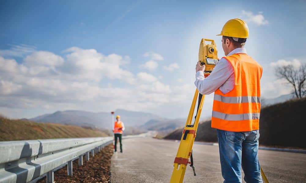
Not all land surveyors are the same. To ensure you get accurate results, choose a surveyor with the right experience and credentials.
Questions to Ask Before Hiring a Land Surveyor:
✅ Are you licensed in Alabama? – Make sure they are legally authorized to perform surveys.
✅ What types of surveys do you specialize in? – Pick one that matches your needs.
✅ Can you provide references or past projects? – A reputable surveyor will have positive reviews.
✅ How long will the survey take? – Get a clear timeline for your project.
✅ What will the survey cost? – Compare pricing but don’t sacrifice quality for a lower rate.
A good surveyor will save you time, money, and legal trouble, so it’s worth choosing wisely.
Protect Your Investment with a Land Survey
Land surveying is a critical step in buying, selling, or developing property. It protects you from legal disputes, ensures compliance with regulations, and provides the information needed for smart decision-making.
For those buying or building in Baldwin or Mobile County, hiring a reliable land surveyor in Mobile, AL, or Daphne, AL will help you navigate local regulations and protect your investment.

