If you’ve worked in development, surveying, or land planning in Auburn, you’ve likely come across LiDAR mapping. It’s a powerful technology that’s changing how professionals analyze and understand the land. But what exactly is it?
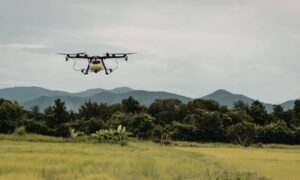
LiDAR stands for Light Detection and Ranging. It’s a cutting-edge mapping method that uses laser light to measure the shape and surface of the ground. Mounted on drones or vehicles, LiDAR sensors scan an area and collect millions of data points. These points are then used to create accurate, high-resolution 3D maps and terrain models.
How LiDAR Works in Simple Terms
Think of it like shining a flashlight across a field and measuring how long it takes for the light to bounce back. Now imagine doing that thousands of times per second. That’s how LiDAR creates a full picture of the ground—including trees, buildings, slopes, and more.
Why It’s Catching On in Auburn
Auburn is growing fast. With new buildings, roads, and infrastructure projects happening all around the city, developers and engineers need tools that are fast and accurate. That’s where LiDAR mapping in Auburn, AL is making a big difference.
How the LiDAR Mapping Process Works
LiDAR might sound high-tech (and it is), but the process is surprisingly smooth. Here’s a breakdown of how most local projects work:
1. Site Assessment and Flight Planning
Before anything flies, the mapping team visits the site or reviews satellite imagery. They decide where the drone or vehicle should scan and set safety guidelines.
2. Data Collection
Using a drone or truck with LiDAR equipment, the survey begins. Most average-size projects take just a few hours to scan.
3. Data Processing and Map Creation
Once the scan is complete, the raw data is cleaned up using software. The final deliverables often include:
- 3D terrain models
- Digital elevation maps (DEMs)
- Contour lines and elevation profiles
- High-resolution aerial images
4. Delivery and Review
Within a few days, you’ll receive the final maps and files—ready for use in CAD, GIS, or planning software.
Costs of LiDAR Mapping Services in Auburn, AL
One of the most common questions is: How much does it cost?
What Affects the Price
Several factors impact the cost:
- Size of the area to be mapped
- Type of terrain (flat vs wooded vs hilly)
- Type of deliverables required
- Flight permits or FAA regulations (if using drones)
- Urgency or custom data requests
Average Pricing in Auburn
Most LiDAR mapping services in Auburn, AL range from:
- $1,000 – $3,500 for small properties or lots
- $4,000 – $10,000+ for large commercial or municipal projects
These prices often include the drone flight, data processing, and final map delivery.
Compared to Traditional Surveying
While LiDAR may have a higher upfront cost, it saves time and labor—especially on large or complex sites. Many clients find the cost difference is worth it in speed and accuracy.
Local Use Cases of LiDAR Mapping in Auburn
Wondering who’s using LiDAR in Auburn and for what? Here are some real examples.
- Urban Planning & Infrastructure. City planners use LiDAR to analyze elevation for stormwater systems, road grading, and zoning. It’s especially useful in hilly or flood-prone areas.
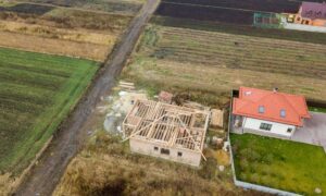
- Real Estate and Site Planning. Developers scan large lots before breaking ground. LiDAR helps identify flat zones for building and areas to avoid, like wetlands or steep slopes.
- Environmental and Flood Risk Assessment. LiDAR can map water flow and floodplains in detail. That’s a big win for engineers designing safe, sustainable spaces.
- Agriculture and Land Management. Farmers and landowners use it to plan irrigation systems, manage slopes, and understand how water moves across fields.
How to Choose a LiDAR Mapping Provider in Auburn, AL
Not all providers are the same. Whether you’re hiring drone experts or traditional land surveyors in Auburn, AL, it’s important to choose a team with the right tools and local experience.
What to Look For
- Experience with LiDAR-specific technology
- Knowledge of Auburn’s terrain and local zoning rules
- FAA-certified drone pilots (if using drones)
- Fast turnaround times and data quality guarantees
Smart Questions to Ask
- How accurate is your LiDAR system?
- What’s included in the quote?
- How long will it take to get results?
- Can I use the data in my current software?
FAQs
- How long does a LiDAR project take?
Most small-to-medium projects are completed within 3–5 business days. - Do I need permits for drone flights?
Your provider should handle that. Commercial drone use follows FAA rules. - Can LiDAR work in wooded areas?
Yes. It penetrates through vegetation to map the bare earth underneath. - Is it safe and environmentally friendly?
LiDAR is completely safe—no digging, chemicals, or disruption to the land. - What formats are the final maps in?
Most providers deliver files in CAD, GIS, or custom formats for planners and engineers.
