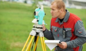
Mapping the land has come a long way. What used to take weeks with measuring tapes and tripods can now be done in a single day—thanks to advanced technology like remote sensing. One of the most powerful tools in this field today is LiDAR, and it’s changing the way we look at land surveying, construction, and land development.
Whether you’re planning a highway, designing a neighborhood, or working on environmental studies, understanding how LiDAR works can help you see why so many professionals are using it to get the job done—faster and more accurately.
What is LiDAR? A Quick Overview
LiDAR stands for Light Detection and Ranging. It may sound complex, but the concept is pretty simple: LiDAR uses laser beams to measure distances from above. These lasers bounce off the ground and objects, sending back information to create detailed maps.
It’s like giving land surveyors a high-tech flashlight that scans the earth and shows them exactly what’s there—even under trees or on uneven ground.
How LiDAR Fits Into Remote Sensing
LiDAR is a form of remote sensing, which means it collects information about the land from a distance—usually by air. While some remote sensing tools use cameras or satellites, LiDAR uses laser pulses to measure elevation and terrain. This makes it especially useful in land surveying, where accuracy and detail are important.
How Does LiDAR Work in Remote Sensing?
- Laser Pulses and Time-of-Flight Explained Simply
Here’s how it works: a sensor—usually attached to a drone or airplane—sends out rapid pulses of laser light toward the ground. When each pulse hits something (like the ground, a tree, or a building), it bounces back to the sensor. By measuring how long it takes to return, the system calculates the exact distance.
Multiply that process millions of times, and you get a 3D map that shows the shape of the land.
- From Drones to Data: The Collection Process
Today, most land surveyors use drones to fly over areas that need to be mapped. The drone carries the LiDAR sensor and a GPS unit, flying in straight lines over the land. Once the flight is done, the data gets processed into digital models, elevation maps, and detailed terrain views.
Why LiDAR is a Game-Changer in Land Surveying
1. Speed and Precision in Large-Scale Mapping
LiDAR makes it possible to survey large areas—like highways, farms, or entire neighborhoods—in a fraction of the time. It also captures hard-to-see areas that traditional tools might miss.
2. Topographic Models and 3D Visualizations
One of the best parts of LiDAR is the ability to turn raw data into stunning 3D maps. Engineers and developers can use these models to plan where roads will go, how water will flow, and where it’s safe to build.
Common Uses of LiDAR in Land Surveying Projects
- Site Planning, Infrastructure, and Environmental Mapping
LiDAR is used in just about every kind of land project. Whether it’s for building roads, checking flood risks, mapping utility lines, or monitoring land changes over time—it gives professionals the accurate data they need to plan ahead.
- Real-World Applications in Civil Engineering and Construction
LiDAR is especially helpful in civil engineering. In places like Birmingham and Huntsville AL, land surveyors are using LiDAR mapping to support major development projects. From urban revitalization in Birmingham to tech-driven expansion in Huntsville, LiDAR helps engineers understand the land before breaking ground—making projects safer, faster, and more cost-efficient.
Benefits of Using LiDAR for Land Surveys
- Better Accuracy: Pinpoint elevation and distances down to the inch
- Time-Saving: Survey large areas quickly, even in tough terrain
- Safety: No need to send crews into dangerous or hard-to-reach places
- Smart Planning: Helps avoid expensive mistakes during construction
When Should You Hire a Professional LiDAR Surveyor?
If you’re planning a large-scale development or need precise land data, it’s best to hire a licensed land surveyor who specializes in LiDAR. They’ll have the right equipment, FAA-approved drones, and the knowledge to collect and process the data correctly.
Working with experts ensures your results are accurate—and recognized by engineers, architects, and local governments.
FAQs
1. What equipment is used for LiDAR mapping?
LiDAR sensors, GPS units, and drones or airplanes are commonly used together.
2. Can LiDAR be used in forested or uneven terrain?
Yes! LiDAR can see through tree canopies and map rough ground accurately.
3. How accurate is LiDAR compared to GPS surveying?
LiDAR can be just as accurate—or more so—depending on the conditions and equipment used.
4. Is LiDAR safe for use in urban areas?
Yes, LiDAR is safe and non-invasive. It uses light, not radiation or chemicals.
Conclusion: LiDAR is the Future of Smart Surveying
LiDAR makes land surveying faster, safer, and much more accurate. It helps engineers, builders, and planners understand what’s under their feet—before construction even begins. As cities grow and projects become more complex, LiDAR will continue to play a big role in shaping the future of land development.
If you want to get ahead in your next project, working with a trusted land surveyor who offers LiDAR services is a smart move.

