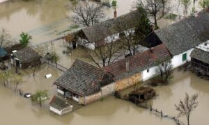
When a city announces a new flood study, most people scroll past the headline. But this week, one story stood out. Midland, Michigan launched a major effort to update its flood maps using aerial mapping, homeowner reports, and property-level data. And it matters more than you might think—especially if you live in Dothan. Dothan gets strong storms, quick downpours, and sudden drainage issues. Because of that, many homeowners ask if an aerial survey can help them understand their land better. It can. And when you see what Midland is doing, it becomes clear why this type of survey is becoming a powerful tool for cities and homeowners across the country.
Why Another City’s Flood Study Should Get Your Attention
Midland didn’t launch this study for fun. They’re dealing with repeat flooding—homes that get hit again and again after big storms. So the city asked residents to report any flooding they’ve seen. Then they combined those reports with aerial maps and elevation information to update their risk zones.
This is important because many flood maps in the U.S. are old. Some haven’t been updated in more than a decade. When storms get stronger or neighborhoods grow, the land changes. Water flows differently. Low spots form. New buildings block drainage. Yet the maps stay the same.
So Midland is doing what many communities will need to do next: gather better data.
And that’s where aerial surveys come in.
What an Aerial Survey Actually Shows

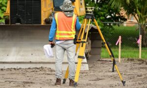
Most people think of a survey as someone walking around with a tripod and sticking metal pins in the ground. That still happens, but aerial surveys give you something different: a detailed view of your entire property from above.
A drone or mapping aircraft collects thousands of data points and captures:
- Small elevation changes you can’t see by eye
- How your yard slopes
- Where rain naturally flows
- Which areas collect water after storms
- High and low points around your home
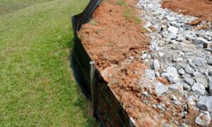
- Surface problems that may cause drainage issues
This is the type of information Midland is using to understand where water goes and why certain areas flood faster than others.
And it’s exactly the kind of clarity homeowners can benefit from.
Why This Matters and the Wiregrass
Dothan has a mix of old subdivisions, new construction, rural tracts, and neighborhoods shaped long before modern drainage rules existed. Because of this, many homes sit in spots where water moves in unpredictable ways.
You might notice your yard holds water after storms. Maybe the back corner stays squishy for days. Or your neighbor’s runoff slides into your driveway. Maybe your crawl space feels damp after every heavy rain. These problems seem small at first, but they can turn into real issues later.
A quick aerial survey lets you see the whole picture at once, instead of guessing what’s happening under the grass.
Even better, the data helps you make smart decisions before problems start.
Flood Maps Don’t Always Tell the Whole Story
Most people trust FEMA flood maps without question. However, they can miss smaller flood-prone pockets inside neighborhoods. A lot of flooding doesn’t come from rivers. Instead, it comes from:
- Poor grading
- Shallow slopes
- Blocked drainage paths
- Low areas around homes
- Runoff from nearby lots
- Older streets without updated stormwater systems
This is why so many homeowners say, “We weren’t in a flood zone, but our yard still flooded.” It’s also why insurance companies sometimes require updated elevation data, even when FEMA doesn’t.
Aerial surveys fill the gap between the official map and the real world.
If Dothan Launched a Flood Study Tomorrow…
Imagine Dothan announced a study like Midland’s. The city would need homeowners to share:
- Where water pools
- Areas that flood repeatedly
- Parts of the yard that stay wet
- New sheds, driveways, or additions that changed drainage
But they’d also need clean, updated elevation information.
Aerial surveys would allow them to:
- Map low spots
- Trace drainage paths
- Identify new flood risks
- Target areas that need better stormwater systems
Even if Dothan doesn’t launch a study soon, homeowners can still get ahead by understanding their land better.
When you have solid data, you don’t wait for a flood map update to learn your risk.
Real Problems an Aerial Survey Can Catch Early
1. Hidden Low Spots That Hold Water
Sometimes a yard looks flat, but it actually dips just enough for water to collect. After a storm, the puddle appears, and you think it’s normal. But it’s a sign of poor drainage.
2. Drainage That Flows Toward the House
Water should flow away from your home, not toward the crawl space or slab. Aerial elevation data shows if the yard slopes the wrong way.
3. Water Trapped by New Construction
New buildings, fences, and concrete pads can trap runoff and send it back toward your home.
4. Driveway and Shop Placement Issues
Homeowners love adding metal shops, carports, and backyard buildings. But putting a structure in the wrong spot can block drainage and create long-term problems.
5. Areas That Could Impact Insurance Later
Sometimes you’re technically “outside the flood zone,” but your property has clear flood behavior during storms. You want to know this before your next renewal.
What You Actually Get From an Aerial Survey
A good aerial survey gives you a set of maps and 3D models that help you understand your land clearly. You’ll see:
- A detailed topographic layout
- Elevation changes around your home
- Natural drainage paths
- Possible grading or waterflow issues
- Areas where water sits too long
- Places where a building pad or shed should not go
In short: you get a clear plan for fixing problems before they cost real money.
Aerial Surveys Are Becoming Popular in Alabama
More homeowners are turning to aerial data because:
- Storms are stronger and more frequent.
- Drainage issues are harder to predict.
- Builders want accurate elevation data before construction.
- Real estate buyers ask more questions about land risk.
- Insurers pay more attention to property-level flooding.
People want answers that old maps and simple walk-throughs can’t provide.
Should You Get One for Your Property?
If any of these apply to you, the answer is yes:
- Your yard has standing water after storms
- You’re planning to build a shop or addition
- You’re worried about drainage
- You live in an older subdivision
- Your home sits lower than nearby houses
- You want to improve resale value
- You want updated flood risk information
For most homeowners, an aerial survey brings peace of mind. For others, it prevents expensive mistakes before concrete is poured.
Either way, it gives you clarity.
Final Thoughts
Cities like Midland are updating their flood maps because storms are changing and old data isn’t enough. Dothan may not be running a study right now, but homeowners don’t have to wait.
An aerial survey gives you the kind of property insight that used to be available only to cities or engineers. You see your land clearly, understand your flood risk, and plan home projects with confidence.
When you know how water moves around your property, you protect your home, your money, and your peace of mind—long before the next storm hits.


