
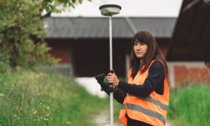
land surveying
LiDAR Mapping: How the USGS Update Changes Projects
Big news recently changed how land data works across the country. The U.S. Geological Survey (USGS) finished its nationwide 3D Elevation Program, called 3DEP. In
Big news recently changed how land data works across the country. The U.S. Geological Survey (USGS) finished its nationwide 3D Elevation Program, called 3DEP. In
Buying land or owning property feels simple at first. You look at your yard, see the fence, and assume that’s the line. Maybe the neighbor
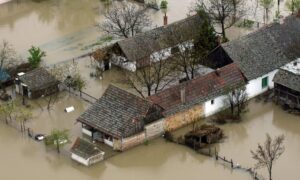
Flooding used to feel like a rare event. Now, for many property owners, it feels like a recurring problem. After recent flooding and drainage failures,