Solar storms might sound like something that only matters to astronauts or satellite engineers, but they can affect life right here in Daphne—especially for anyone doing a construction staking survey. When the sun’s magnetic activity flares up, it can scramble GPS signals and make it harder for survey crews to get accurate positions. That’s a big deal for local projects where every inch matters—like staking curbs, drainage lines, and building corners.
The Hidden Force in the Sky
This week, NOAA and the Space Weather Prediction Center issued alerts about increased solar activity. It may not make headlines every day, but these solar storms can bend and twist the signals that GPS systems rely on. Surveyors who use RTK (Real-Time Kinematic) corrections know how precise those systems are—until the ionosphere acts up and suddenly that precision disappears.
For a city like Daphne, where new subdivisions and commercial developments are popping up near Mobile Bay, this is more than a science headline. It’s a real-world challenge. The slightest GPS error during a layout can shift property corners or grade lines, leading to costly rework or inspection delays.
Why It Matters in Daphne
Unlike inland towns surrounded by trees or hills, Daphne sits in a broad coastal plain. That open exposure gives survey gear a clear view of the sky—which is great most of the time. But when solar storms hit, that same openness can mean more interference.
Builders and surveyors here deal with high moisture, sandy soils, and strict drainage requirements. Losing GPS accuracy for even an hour can throw off the slope of a road or the height of a foundation. That’s why it’s critical to understand how to keep a construction staking survey accurate, even when RTK isn’t cooperating.
What a Solar Storm Does to Your Survey
When a solar flare sends charged particles toward Earth, they interact with the upper atmosphere. This layer—the ionosphere—bends radio signals, including the ones your GPS receiver depends on. During normal conditions, your equipment can correct for these tiny distortions. But when a geomagnetic storm hits, those corrections can fail.
Here’s what it looks like in the field: your rover connects to satellites as usual, but your coordinates start “floating.” One second you’re on target; the next, your readings are several tenths of a foot off. The system may show a high PDOP (Position Dilution of Precision), meaning the geometry between satellites isn’t ideal. If you don’t catch it in time, those errors can show up as misaligned footings or off-center pipes later on.
How Local Crews Adapt
Good surveyors don’t panic when space weather interferes—they adapt. The trick is having a plan that keeps work moving without sacrificing accuracy.
Before heading out, many crews check the Kp index, a simple scale that shows how disturbed the Earth’s magnetic field is. A reading of four or less usually means GPS conditions are stable. Anything higher, and you should be on alert.
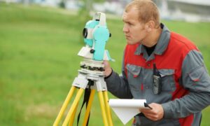
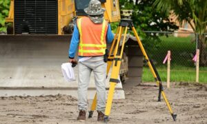
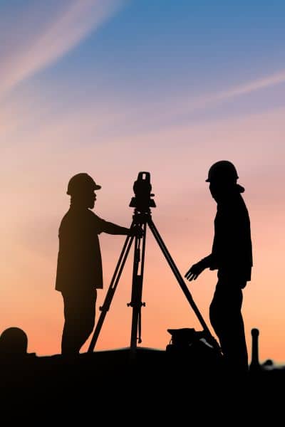
In the field, the best crews keep total stations ready as backup. These instruments don’t rely on satellite signals; instead, they use line-of-sight measurements. When RTK starts drifting, switching to a total station or robotic setup allows work to continue without losing precision.
Another tactic is to take longer observation times at control points. Holding each shot a bit longer and repeating measurements adds redundancy. Later, surveyors can cross-check results and catch any bad data before it becomes a construction mistake.
A Real Daphne Scenario
Picture a crew staking new curbs along County Road 13. The morning starts off fine—clear skies, calm winds, GPS locked onto multiple satellites. Around noon, though, the rover takes longer to fix positions. Readings jump a few tenths, then stabilize, then drift again. The crew checks the NOAA app and sees that the Kp index has spiked to level 6.
They know what to do. The party chief calls a quick switch to total station mode. Using previously set control points, they continue staking without interruption. By afternoon, when the geomagnetic activity subsides, they verify a few critical points with GPS again—everything matches perfectly. The project stays on schedule.
That’s the difference between teams that understand space weather and those that don’t.
Why RTK Isn’t the Only Option
RTK is amazing technology, but it’s only one tool in the box. When conditions aren’t ideal, mixing methods is the smartest move. Hybrid systems—combining GNSS, total station, and laser levels—give flexibility.
For larger or repeat projects, establishing independent local control can save the day. These are permanent points tied to known coordinates, unaffected by temporary GPS outages. Crews can return to them anytime for verification or restaking, even during high solar activity.
Another overlooked step is record-keeping. Surveyors who document conditions, times, and equipment behavior can prove data reliability if questions arise later. For builders, that kind of transparency builds trust—and saves money.
Looking Ahead
Geomagnetic storms aren’t rare anymore. As the solar cycle peaks in 2025, scientists expect more frequent flares and coronal mass ejections. For anyone working outdoors with GPS—surveyors, drone pilots, engineers—it’s a new layer of risk to manage.
The good news is that preparation works. Simple habits like monitoring space weather, using total station backups, and double-checking key stakes keep jobs running smoothly. In fast-growing communities like Daphne, where precision equals progress, these habits separate average crews from great ones.
Final Thoughts
The next time your GPS seems sluggish or inconsistent, it might not be your equipment—it could be the sun. A construction staking survey is only as reliable as the tools and methods behind it. By staying aware of space weather and having solid field practices, surveyors can protect their accuracy and their reputation.
After all, solar storms may be global, but construction precision is always local.
