Why a Boundary Survey Matters Before Adding a Pool to Your Backyard
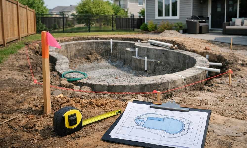
Installing a pool is one of the best upgrades you can make to your backyard. But before any digging starts, you need to know exactly where your property lines are. A boundary survey gives you that information. It maps out the edges of your lot so you and your contractor can plan the project with […]
ALTA Survey vs. Boundary Survey: Which One Do You Need?
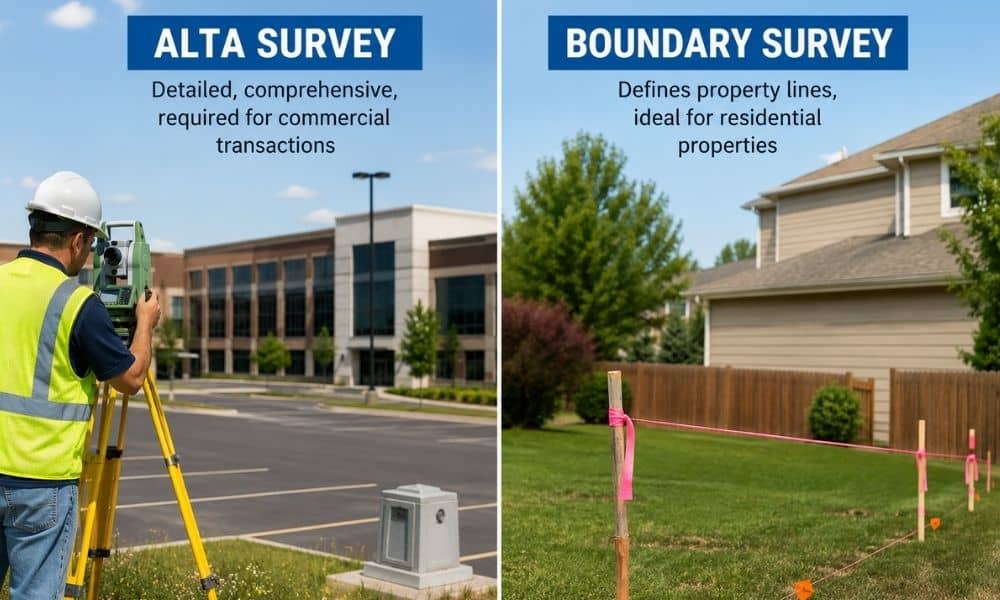
When buying or building on a property, you will likely need a survey. But which kind? The ALTA survey vs. boundary survey question confuses many buyers, investors, and builders. Both deal with property lines, but they are not the same thing. Picking the wrong one can delay your closing or fail your lender’s requirements. This […]
How Much Does an ALTA Survey Cost?
If you are planning a commercial real estate deal, one of the first questions you will ask is: how much does an ALTA survey cost? Knowing the price ahead of time helps you budget properly and avoid delays. ALTA surveys are not a flat-rate service. The final cost depends on property size, location, complexity, and […]