What is a Boundary Survey and Why It Matters
Ever wonder where your property truly begins and ends? A boundary survey provides the legal evidence. It’s a precise mapping of your property’s limits using physical markers and land records, conducted by a licensed land surveyor.
For homeowners, it’s crucial when installing fences or additions. For developers, it’s non-negotiable before subdividing land or breaking ground. Skipping this step can lead to legal headaches, neighbor disputes, or project delays.
Understanding Legal Property Boundaries
Legal property lines aren’t always as obvious as a fence or driveway. A boundary survey uses:
- Deeds and historical land records
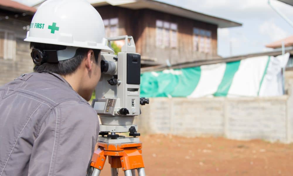
- GPS and total station equipment
- Monumentation (like iron rods or stakes)
Why It’s Required for Construction
Municipalities often require a boundary survey before granting permits, especially for:
- Home expansions
- Decks or garage builds
- Commercial developments
Common Scenarios That Require a Boundary Survey
Many people discover the need for a boundary survey when they’re already deep into planning—or facing a problem.
Home Additions and Fence Installations
Building too close to—or over—a neighbor’s property line can trigger zoning violations and costly legal disputes. Always confirm boundaries before:
- Installing a new fence
- Adding a shed, patio, or pool
- Starting landscaping that affects neighboring trees
New Construction and Land Subdivisions
Real estate developers rely on boundary surveys for:
- Splitting large lots into smaller parcels
- Creating new neighborhoods or commercial zones
- Avoiding costly rework due to zoning miscalculations
What Does a Boundary Survey Include?
A complete boundary survey includes both fieldwork and documentation.
Physical Markers and Survey Monuments
Surveyors place visible markers such as:
- Rebar rods or concrete monuments
- Flags or wooden stakes
These markers correspond to legal boundaries.
Plat Maps and Legal Descriptions

You’ll receive:
A legal description: outlining metes and bounds, curves, and coordinates
A plat map: a detailed drawing of the property
How to Read a Boundary Survey Report
Understanding the report helps you make informed decisions.
Key Elements to Look For
- Property dimensions and angles
- Setbacks and easements
- Encroachments or conflicts
Common Symbols and Terms
Look for terms like:
- ROW (Right-of-Way)
- Easement: legal permission for access/utilities
- Bearings and Distances: direction and length between markers
Who Performs a Boundary Survey?
The Role of a Licensed Land Surveyor
A licensed land surveyor is trained to interpret land records, operate surveying tools, and apply zoning regulations.
Certifications and State Requirements
In the U.S., surveyors must:
- Be state-certified
- Adhere to local and national survey standards (such as ALTA/NSPS)
You can find licensed professionals through the National Society of Professional Surveyors.
How Much Does a Boundary Survey Cost?
Average Costs Across the U.S.
Prices vary by region, but expect:
- $400–$1,200 for typical residential lots
- More for irregular or large parcels
Factors That Influence Pricing
- Terrain difficulty (wooded or sloped areas cost more)
- Property size and complexity
- Availability of historical records
Read more about land survey cost factors.
The Boundary Survey Process Explained
Step-by-Step Breakdown
- Initial research: Surveyor reviews deeds, plats, and public records
- Fieldwork: Uses tools like GPS, total stations, and drones
- Marking boundaries: Flags and monuments placed on site
- Final report: Includes a certified map and description
What Homeowners and Developers Need to Prepare
- Deed or title info
- Previous survey maps, if available
- Site access during fieldwork
Boundary Surveys vs. Other Types of Land Surveys
| Survey Type | Purpose |
| Boundary Survey | Identifies property lines |
| Topographic Survey | Maps terrain, contours, and elevation |
| ALTA Survey | Detailed survey for title and lender purposes |
| Lot Survey | Basic plot dimensions, often used for homes |
Legal Implications of Inaccurate Boundary Surveys

A faulty survey can derail transactions or trigger lawsuits.
Property Disputes
Neighbor disputes over fences, driveways, or trees often trace back to unclear or incorrect boundary lines.
Title and Zoning Issues
Inaccurate surveys can:
- Delay closings
- Violate zoning ordinances
- Jeopardize insurance and financing
Real-World Use Cases from U.S. Projects
- Huntsville, AL: A homeowner prevented a property dispute by surveying before building a fence.
- Montgomery, AL: A developer used boundary and topographic surveys to successfully split a 5-acre tract into 12 lots.
- Troy, AL: A flood-prone area required a FEMA elevation and boundary survey before retail development could proceed.
When Should You Order a Boundary Survey?
During Real Estate Transactions
It’s wise to confirm boundaries before:
- Buying or selling a home
- Applying for title insurance
- Resolving estate inheritances
Before Any Construction Begins
Local permitting offices may require a survey for:
- Garages, decks, or room additions
- New home builds
- Utility work or driveways
Choosing a Reliable Land Survey Company
What to Look For in a Professional Surveyor
- Proper state licensing
- Experience in local zoning laws
- Clear reporting and communication
Questions to Ask Before Hiring
- “How long will the survey take?”
- “Do you provide a digital plat map?”
- “Can you coordinate with my builder or title company?”
Explore our land surveying services in Alabama for more details.
Conclusion
A boundary survey isn’t just for major construction—it’s an essential tool for anyone who owns or plans to buy land. Whether you’re adding a fence, building a home, or subdividing property, a survey ensures you stay within legal limits and avoid costly surprises.
Frequently Asked Questions about Boundary Surveys
Q1: Is a boundary survey the same as a plat?
A: Not exactly. A plat is the map generated from the survey. The boundary survey is the full process of determining and marking property lines.
Q2: Do I need a boundary survey to sell my house?
A: Not always required, but highly recommended to avoid disputes and title delays.
Q3: How long does a boundary survey take?
A: Typically 1–2 weeks, depending on complexity and surveyor availability.
Q4: Can I use an old survey for my project?
A: Not always. If the property has changed or regulations have updated, a new survey is often needed.
Q5: What if my neighbor disputes the boundary?
A: A certified boundary survey holds legal weight and can help resolve such issues.
Q6: Are boundary surveys public record?
A: No, but they may be submitted with permits or recorded with the county.
