In Lafayette, AL—where open farmland meets small-town development—questions about property boundaries can quickly turn into disputes. Whether you’re building a fence near Veterans Parkway or purchasing land along Avenue A, a boundary line survey in Lafayette, AL can help resolve questions before they become costly conflicts. Knowing exactly where your property begins and ends protects your investment and helps maintain good neighbor relationships.

Why Property Boundaries Matter in Lafayette
Land ownership in rural and semi-rural areas like Lafayette comes with unique challenges. With wooded lots, inherited family parcels, and older deeds common in areas like Buffalo and Five Points, it’s not unusual for property lines to be unclear or misinterpreted.
In newer subdivisions near downtown Lafayette or near Chambers County High School, surveys may exist—but aren’t always accurate to current conditions. Natural features shift, fences are moved, and over time, even minor inaccuracies can lead to disputes.
That’s where a professional boundary line survey becomes essential. It gives both landowners and neighbors clear documentation of where one property ends and the next begins.
What Is a Boundary Line Survey?
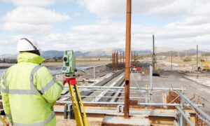
A boundary line survey is a detailed measurement of your property’s legal borders. Licensed surveyors review historical deeds, property records, and subdivision plats. They then physically measure the land using tools like total stations and GPS.
The results include:
- A map showing exact property lines
- Markers placed at corners or along boundaries
- Notes on encroachments, easements, or overlaps
- Legal descriptions that match public records
This official record can be used in legal situations, permit applications, land sales, or when negotiating with neighbors.
When You Should Consider a Boundary Line Survey
Before Building or Renovating
If you’re planning to build a fence, garage, driveway, or addition, a boundary line survey helps ensure you’re not crossing over into someone else’s land. This is especially important in Lafayette where many lots are not perfectly rectangular, and lot markers may be missing or incorrect.
H3: When Selling or Buying Property
A clean, verified boundary line can speed up real estate transactions and avoid title issues. Whether it’s a vacant lot off Alabama Highway 50 or a residential parcel near South LaFayette Street, buyers want confidence in what they’re getting.
H3: During Family Land Transfers
In Lafayette and other areas of Chambers County, it’s common for land to be passed down through generations. Over time, undocumented boundary changes can cause confusion. A boundary line survey clears that up for heirs or future buyers.
H3: If a Dispute Is Brewing
Even friendly neighbors can disagree. If someone builds a fence, cuts down trees, or claims part of your land as theirs, a boundary survey is the objective way to resolve the issue. It provides the evidence needed to support your property rights.
Common Causes of Boundary Disputes in Lafayette
Property disputes aren’t always dramatic, but they can escalate quickly. Here are a few situations we often see in and around Lafayette:
- Fencing built across boundary lines
- Driveways or sheds encroaching on neighboring land
- Confusion from old or hand-drawn plats
- Trees or natural features used as markers instead of verified surveys
- Unclear lot lines in older neighborhoods or subdivisions
In areas like Ridge Grove and Standing Rock, where rural properties often have informal markers, these issues are especially common.
Local Rules and Property Challenges in Lafayette, AL
Lafayette falls under Chambers County’s jurisdiction, which means building permits, land use, and setback requirements must meet county regulations. Some projects may also require approval from the City of Lafayette Planning Department. These local rules often require surveys for:
- Permit applications for new construction
- Lot line adjustments or subdivisions
- Resolving legal claims related to encroachments
And because much of Lafayette’s terrain includes gently rolling hills and wooded lots, accurate surveying becomes more difficult—making it even more important to hire a licensed local surveyor who understands the topography and land use history of the area.
How a Boundary Survey Helps You Avoid Legal Trouble
A boundary survey protects your investment in several key ways:
- Avoids accidental encroachment when building or landscaping
- Supports legal claims if a neighbor challenges your land use
- Prevents future resale problems by providing documentation
- Simplifies title insurance for both buyers and lenders
It’s not just about peace of mind—it’s about protecting property value and avoiding expensive legal battles later.
Choose a Surveyor Who Knows Lafayette
Working with a local land surveyor familiar with Lafayette and Chambers County means you get someone who understands:
- The quirks of rural land parcels
- Regional terrain and soil types
- County permitting requirements
- Historic land use and subdivision trends
A surveyor who’s worked in areas like Marcoot, LaFayette Heights, or even nearby Cusseta can often spot potential issues early—saving you time and money.
Invest in Clarity, Not Conflict
When it comes to property, uncertainty is risky. Whether you’re preparing to build, settle a dispute, or sell a parcel, a boundary line survey in Lafayette, AL is a wise investment.

If you’re unsure about your property boundaries—or want to be sure before making a major decision—speak with a licensed local surveyor in Lafayette. They can help you protect what’s yours with precision and professionalism.
