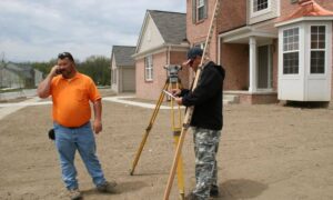

Before any fence goes up or a contractor pulls a tape measure, most homeowners feel confident they know where their property ends. After all, the yard has always looked the same. The fence line feels obvious. The neighbor never complained. However, this is exactly where many problems begin. A boundary survey helps confirm legal property lines, but even before ordering one, homeowners should slow down and do a simple pre-check. That small pause can save time, money, and stress later.
Why Problems Start Before Construction, Not During It
Most boundary issues do not start with bad intentions. Instead, they start with confidence based on habit. You mow the same area every week. You park in the same spot. You assume the old fence shows the line. Because nothing went wrong before, it feels safe to move forward.
However, building changes everything. Once you plan a fence, driveway, shed, or addition, small mistakes suddenly matter. Even a few inches can cause delays, redesigns, or tense conversations. That is why the smartest time to think about boundaries is before calling a contractor.
Taking a few minutes to check your situation helps you avoid rushing into decisions that feel simple but carry long-term effects.
What This Pre-Check Is Meant to Do
This pre-check is not about measuring land or proving ownership. Instead, it helps you step back and ask the right questions early. Think of it as a planning filter. It helps you decide whether you need clearer information before moving forward.
Many homeowners skip this step because they feel it slows things down. In reality, it often speeds projects up. When you plan with clarity, contractors work with fewer pauses. Permits move smoother. Changes happen on paper instead of on concrete.
Most importantly, you gain confidence before spending money.
Start With the Type of Project, Not the Lot Size
Homeowners often focus on how big their yard is. However, size matters less than where the work happens. Projects near property edges carry higher risk, even on large lots.
For example, fences, retaining walls, driveways, garages, sheds, and patios often sit close to boundaries. Even when they seem minor, they lock in positions that are hard to change later. Because of this, projects near edges deserve more thought than projects near the center of the yard.
If your plans touch the outer areas of your property, pause and consider whether you truly know where those lines sit.
Watch Out for False Confidence
Many homeowners rely on things that feel official but are not reliable enough for construction decisions. Old fences, tree lines, landscaping borders, and even long-used paths create strong visual cues. Over time, these cues feel like facts.
Online parcel maps add another layer of confusion. While helpful for general reference, they do not show legal boundaries with construction accuracy. They exist for tax and planning purposes, not for building placement.
Because these sources look convincing, they create false confidence. As a result, homeowners move forward without verifying anything. That confidence feels good at first, but it often leads to problems later.
Learn to Spot Early Warning Signs
Not every project needs immediate surveying. Still, some signs suggest you should slow down and gather more clarity. Missing corner markers often raise questions. Irregular lot shapes also increase uncertainty. Older neighborhoods and rural parcels commonly lack clear records on the ground.
Shared features matter too. Shared driveways, access paths, and utility areas blur boundaries over time. When multiple properties interact, assumptions become risky.
These signs do not mean a dispute exists. Instead, they suggest that guessing could lead to mistakes.
Gather the Right Information Early

Before calling a surveyor or contractor, gather basic property information. This step does not take long, yet it helps professionals guide you better.
Start with your property address and parcel or tax ID. If you have a deed or old survey, locate it. Even incomplete documents provide helpful context. Having this information ready prevents back-and-forth conversations and speeds up next steps.
Preparation also helps professionals recommend the right service. When you explain your project clearly, you avoid ordering work that does not match your needs.
Why This Pre-Check Saves Time Even When You Order a Boundary Survey
Some homeowners worry this step delays projects. In reality, it does the opposite. When you approach professionals with clear goals and information, timelines tighten instead of stretching.
A boundary survey works best when ordered at the right moment. When done early, it guides layout decisions instead of correcting mistakes. Contractors appreciate clear lines because they reduce guesswork. Homeowners appreciate fewer changes once work begins.
Most importantly, early clarity protects relationships. Neighbors stay comfortable when boundaries stay clear from the start.
Planning Builds Confidence, Not Doubt
Some people avoid thinking about boundaries because they fear uncovering problems. However, clarity does not create issues. It reveals them early, when solutions remain simple.
Building always involves risk. Still, informed planning reduces that risk. By doing a short pre-check, you shift from reacting to controlling the process. You replace assumptions with awareness.
That shift alone often changes how smoothly a project unfolds.
Build With Clarity, Not Assumptions
Every successful project starts with good decisions made early. A boundary survey provides legal clarity when needed, but timing matters. Before calling contractors or ordering work, pause and review your situation.
Ask where the project sits. Question what information you rely on. Gather simple details. When uncertainty exists, address it early instead of hoping it disappears.
In the end, building with clarity protects your investment and your peace of mind. A few thoughtful steps before construction begins can prevent months of frustration later.