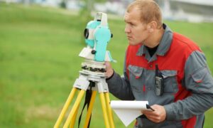
How to Find Someone to Survey Your Property Boundary Correctly

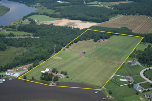
There are different reasons why somebody would need boundary surveying in their property. Often, this type of surveying is done if the owner of the property wants to legally place an item on the property such as a new structure or a fence.

A Licensed Land Surveyor

When hiring a land surveyor, you have to make sure that he is duly licensed by your state. A “licensed” land surveyor means he was able to complete his studies, passed all exams and is certified to perform specific types of land surveys.

Hiring a licensed land surveyor is especially important if there is a dispute over a certain area of a property as the court would be asking for the current boundary survey result as well as testimony from a licensed land surveyor. With this being said, you also have to make sure that the surveyor you’re going to hire can also stand as an expert witness in court.

Looking for a Licensed Land Surveyor
If your property has been surveyed before, it would be easier for you to contact that land surveyor again. This is the best option for several reasons; he already has all information about your property, making it easier for him to perform a new type of survey.

You can typically find your land surveyor’s information on the survey result given to you (if you’ve bought the property from somebody, for instance) or the result given to you by the surveyor himself.

If you don’t have the survey drawing, you can also check the markers put in place by the surveyor during the last survey done on your property. These markers, which looks like iron pegs or pipes, should have the surveyor’s license number/ name on it. You can use this information to find the surveyor online.

If you can’t find the surveyor who worked on your property before, or if the property has never been surveyed, you should easily find a land surveyor in your area (for a land surveyor in the Alabama area, click here).

Important Points to Remember when Hiring an ALTA Surveyor

  • As mentioned, make sure that he or she is a licensed land surveyor.
  • He or she should have experience in performing alta boundary surveys. If you’re going to pay somebody, you’d rather have someone who has done it before, right?
  • Look for someone easy to talk to. Communication is very important when hiring a land surveyor. You see, surveying is more of an art than a science – this is why land surveying results vary. It’s important that your surveyor understand why you’re having the survey, what you’re going to use the results for and how soon you’ll be needing the results.
author avatar
Surveyor

More Posts

Land surveyors conducting an ALTA Land Title Survey on a commercial construction site before development begins
alta survey
Surveyor

Beat the Clock: Schedule Your ALTA Land Title Survey Early

When the City of Huntsville approved a new $240 million retail center in North Huntsville, it marked another big step in the city’s growth story. New stores, restaurants, and office spaces are on the way, and construction teams are already lining up their next moves. But behind every successful project

Read More »
A licensed pilot launches a drone near a modern city building for drone mapping work under new municipal rules
land surveying
Surveyor

How City Policies Are Reshaping Drone Mapping Work

Across the U.S., cities are starting to rethink how drones are used in public spaces. In late October, Raleigh, North Carolina, passed new rules limiting when and where drones can take off or land in city parks. The move quickly got attention from engineers and surveyors who rely on drone

Read More »
Aerial view of a construction site with solar panels and foundation work, symbolizing how solar storms can impact construction staking survey accuracy.
land surveying
Surveyor

Protect Your Construction Staking Survey from Storms

Solar storms might sound like something that only matters to astronauts or satellite engineers, but they can affect life right here in Daphne—especially for anyone doing a construction staking survey. When the sun’s magnetic activity flares up, it can scramble GPS signals and make it harder for survey crews to

Read More »
Two construction surveyors using a GNSS rover and field notebook under dense tree canopy showing RTK signal challenges
land surveyor
Surveyor

When RTK Drops, Here’s How Construction Surveyors Recover

If you’ve worked on a job site, you already know how unpredictable the field can be—especially for construction surveyors working under tree cover or in remote areas. One minute your RTK system is locked in; the next, your signal drops out and your GPS rover can’t hold a fix.  When

Read More »
Homeowners meeting with a land surveyor during a boundary line survey to review property boundaries
boundary surveying
Surveyor

The ‘Stakes Moved’ Debate and the Boundary Line Survey Fix

It started with a viral post: two neighbors arguing because one claimed the other had “moved the stakes.” The comments exploded—some said fences show the real property line, others insisted it’s wherever the metal pins are buried. The truth? None of them were completely right. When emotions run high and

Read More »
FEMA-style flood map overlay with property survey parcel lines showing high-risk flood zones
boundary surveying
Surveyor

Property Survey: How to Check Flood Risk First

Decatur is no stranger to water. With the Tennessee River and Wheeler Lake shaping the city’s edges, flood risk is always part of the conversation when it comes to land and property. Before you order a property survey for a new build, a home purchase, or an insurance requirement, it

Read More »